|
Philip CLUVER , Introductionis in Universam Geographiam...,Amsterdam 1661 & Johann Christoph BECMANN , Historia Orbis Terrarum , Geographica , Frankfurt & Leipzig 1707 . 4to (203x165mm) . Latin . |
|
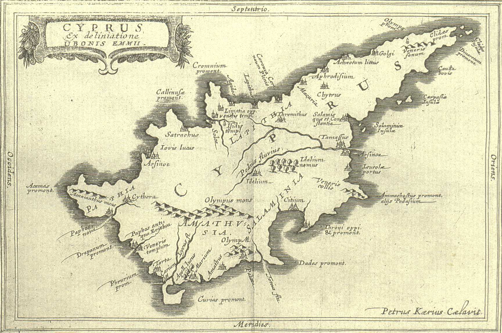
Two distinct books bound together ; both deal with the history and geography of the world and were basic geography texts with wide circulation . Culver's Introductionis in Universam Geographiam includes a map of Cyprus . The book is a small Atlas of the world with 46 maps , one of each main country . It was first published in 1624 without maps and because it was well received it went through many issues in the 17th. And 18th. centuries . However , not all Cluverius' editions contain a map of Cyprus , and those that do , show four different versions . The present edition contains the third version of the map ( Fig. 44 of 1661 above) and it is of particular importance because it was published by Joannes Janssonius . The map of Cyprus is by the famous Dutch engraver Petrus Kaerius . Cyprus is the 42nd map in the "Index Tabularum". It is a double-page map , preceding page 127 at the end of Liber V where the text on Cyprus begins (pp 127-128). The title reads "Cyprus Ex deliniatione Ubonis Emmii" (130x195mm) . Emmius was a cartographer , who worked for Hondius and Janssonius . The map is based on the Parergon (1584) map of Ortelius (Fig. 11) but its shape is rather deformed and it has fewer ancient contents . |
|
![]()
|
|
|