|
Olfert (Olivier) DAPPER , Description Exacte Des Isles De L' Archipel , Amsterdam 1703 . Folio (360x270mm) . French . |
|
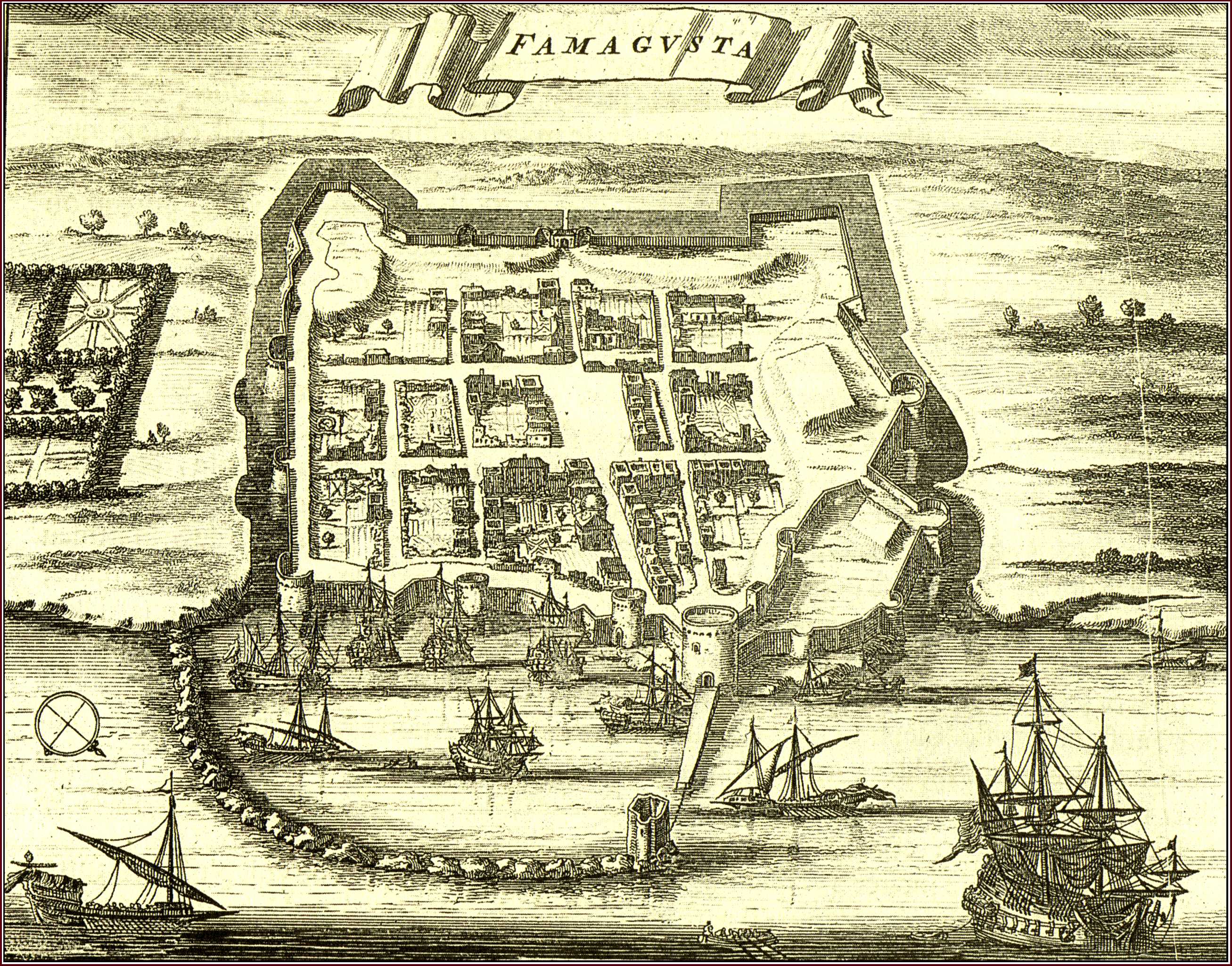
A folio book originally published in Dutch as Naukeurige Beschryving der Eilanden in de Archipel der Middelantsche Zee...(Amsterdam 1688) . The present , French edition was published by George Gallet in Amsterdam . Dapper's book is a magnificent production as far as printing is concerned and at the same time an interesting source for the islands of the Archipelago . Dapper never visited the places he described in his book . He compiled his descriptions from the writings of known travellers , or from the accounts of seamen . The text on Cyprus ("De l'Ile de Cypre") on pages 21-88 , is preceded by a double-page map of the island entitled "Cyprus Insula" (287x374mm) (Fig. 48). The author of the map remains unknown but his prototype was Blaeu or Janssonius (Fig. 37) Dapper's map is basically distinguished from its prototype because of a new marine composition at the lower right corner that replaces Blaeu's Aphrodite and swans of Fig. 37 .The extensive text is illustrated with two other Cyprus items . The first is a town plan of "Famagouste" (125x160mm) (the one above) on page 30 which accompanies the relevant account entitled "De la ville de Famagouste" (pp 29-31) . It is a conventional , three-dimensional view which does not include the numerous churches of the town . Nevertheless , it is an important plan for the study of the town's fortification system , as it resembles a wooden model at the Museo Storico Navale in Venice which is labelled "Fortezza di Famagosta" and dated 1571 (see also Fig. 56) . The last Cyprus item is a double-page engraved illustration of the Larnaca harbour seen from the sea and depicting the fort and the church of St. Lazarus . It is entitled "Salinas of Soutpannen anders Arnica di Salinas ou les Salines" (280x343mm) and it precedes the relevant account , "De la ville d' Arnica ou D' Arnacho" on pages 33-35 . |
|
![]()
|
|
|