 |
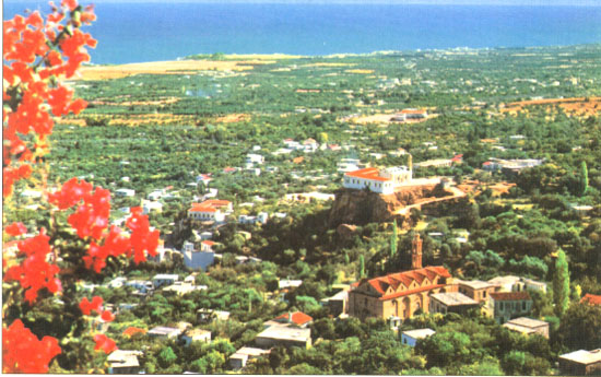
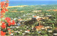
A
panoramic view of Lapithos sometime before the Turkish invasion of 1974.
The church in the front part of the picture is Ayia (Santa) Paraskevi.
Sitting on the top of a hill in an "L" shape is the second
elementary school with the church of Ayias (Santa) Anastasias inside its
yard. On the left of the same hill in a "pi" shape is the first
elementary school.
Click photo to enlarge.
|
 |
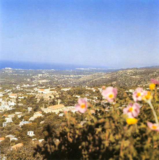
Another
panoramic view of Lapithos. The Greek Orthodox Church in the front part of
the picture is dedicated to Ayia (Santa) Paraskevi. Sitting on the top of
a hill in a GREEK "Γ" (Γάμμα-Gamma)
shape is the Second Greek Elementary School with a Greek Orthodox Church
of Ayia (Santa) Anastasia. Lapithos was very well known for its beautiful
gardens of all kinds of citrus trees. Olive trees were also very common.
Click photo to enlarge.
|
 |
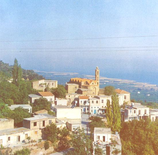
A
panoramic view of Lapithos looking from east to northwest. The Greek
Orthodox Church of Ayia (Santa) Paraskevi can be seen. The altitude
difference between the northern and western parts of the town is very
prominent. This unique combination of mountain and sea makes Lapithos one
of the most beautiful places on earth. Most of the houses in the flat part
are not visible because are hidden by the green of the citrus gardens.
Click photo to enlarge.
|
 |
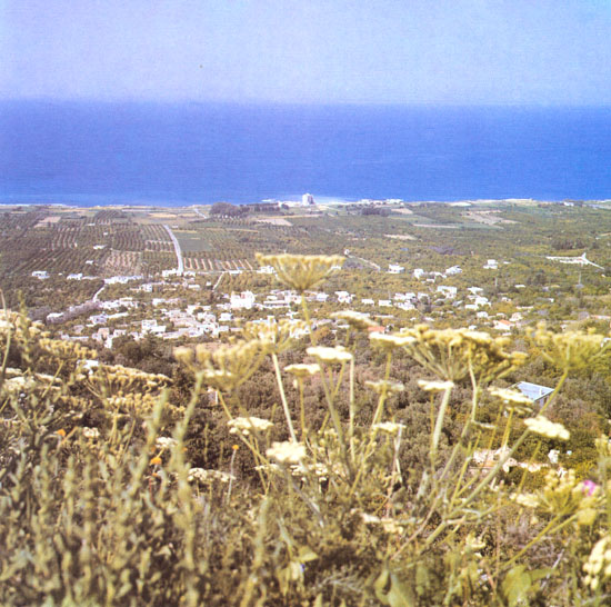
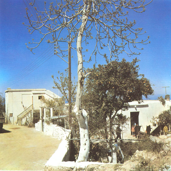
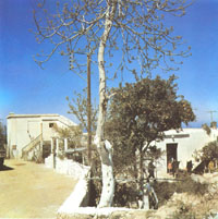
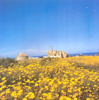
Lapithos
had a unique flora. The people used to cultivate almost anything from
cotton to citrus fruits.
Click photo to enlarge.
|
|
|
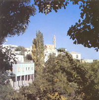
A view of
Ayia (Santa) Paraskevi parish looking northwest. The Greek Orthodox Church
of the parish devoted to Ayia (Santa) Paraskevi is visible at the back of
the picture. Lapithos had seven Greek Orthodox Churches and forty Greek
Orthodox chapels.
Click photo to enlarge.
|
 |
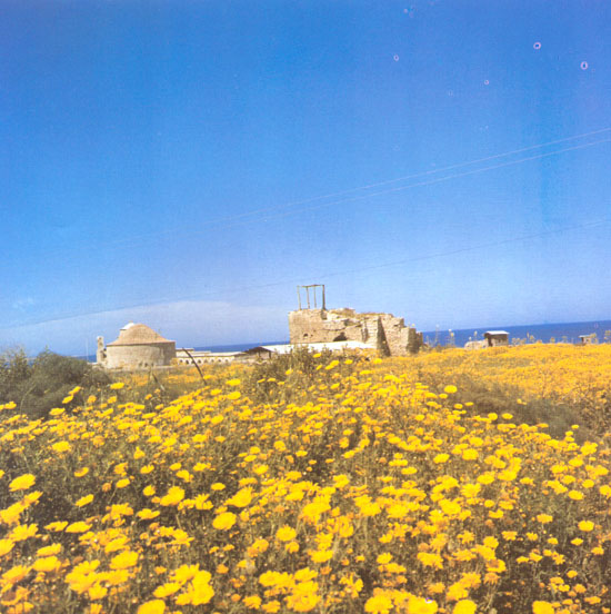
A natural
spring was one of the key factors for the wealth and beauty of Lapithos.
The spring used to supply the residents of the village with up to 250 tons
of water per hour. An elaborate system of canals was distributing the
water among several watermills and then among the citrus gardens of the
village...
Click photo to enlarge.
|
 |
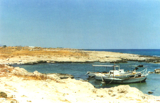
A natural
bay was used by the local fishermen as a harbor fhr their boats. The place
was named "AMMATI" (Greek for eye), after the swirling water
inside the bay.
Click photo to enlarge.
|
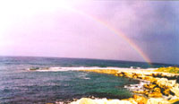 |
A natural
spring of fresh water was refreshing the thisty right on the beach.
Another spring was pouring inside the sea.
Click photo to enlarge.
|
 |
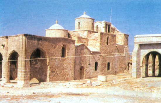
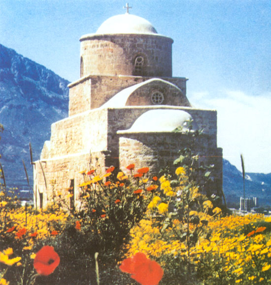
The Greek
Orthodox church of Panayias Acheropoiitos before the Turkish invasion. Its
name suggests that it was not build by human hands, but rather by a
miracle. The inside of the church was decorated with very beautiful
frescoes and icons.
Click photo to enlarge.
|
 |
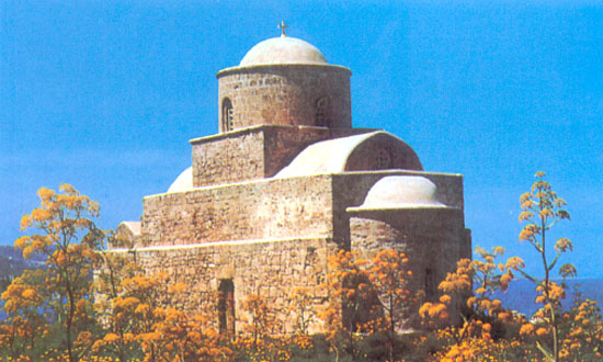
What is
left from the church of Panayias Acheropoiitou after the Turkish invasion.
After the invasion many of the churches were either destroyed, after the
ancient icons and silvers were illegally exported, or they were converted
to mosques.
Click photo to enlarge.
|
 |
The Greek
Orthodox chapel of Ayios (Saint) Evlalios bettween Lapithos and Karavas.
Ayios (Saint) Evlalios helps those who have problems with speech.
Click photo to enlarge.
|
 |
Another
view of the church of Ayios Evlalios.
Click photo to enlarge.
|
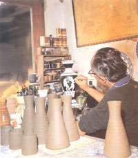 |
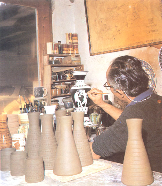
Among
other things Lapithos was also famous for its pottery. A traditional
pottery maker is drawing a scene from Greek Mythology on a vase.
Click photo to enlarge.
|
 |
Women
from Lambousa are known for their skill of the famous Lefkaritiko. It is a
special type of embroidery using a special thread and linen. They used to
make anything from bead covers to curtains and tables clothes in this
special way and especially when having weddings. The dowry of every girl
from Lapithos or Karavas included among other things many embroideries of
this type.
Click photo to enlarge.
|
 |
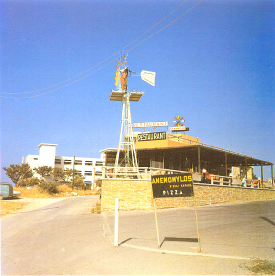
Anemomylos
(windmill) restaurant outside Karavas. The place was also named "Eksi
mili" (the sixth mile) because of its distance westwards from the
city of Kyrenia.
Click photo to enlarge.
|
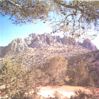 |
Mount
Pentadactylos (five fingers) took its name form this particular part.
Tradition has it that Digenis Akritas grap on the mountain to get out of
the sea when he came to free Cyprus from its invadors, and this is his
handprint.
Click photo to enlarge.
|